
Summarise this article with:
Your phone shares your GPS location automatically in many countries the moment you call emergency services. On Android, Google's Emergency Location Service (ELS) silently sends a high-accuracy fix via SMS when you dial a local emergency number. On iPhone, Apple's HELO system and RapidSOS do the same. In both cases, you do nothing. But automatic systems fail, calls drop, and you may be in an area not yet covered. The methods below give you active options, ranked for the situations where you are most likely to need them.
Quick Reference: Pick Your Situation
| Situation | Fastest Method |
|---|---|
| Urban area, phone works | Call emergency services (AML/ELS shares automatically) |
| You need to actively tell someone your location | GPS coordinates from Compass app or Google Maps |
| Rural or off-road, patchy signal | what3words three-word address |
| No cellular signal, iPhone 14+ | Emergency SOS via satellite |
| No cellular signal, Pixel 9+ | Satellite SOS |
| Deep wilderness, no smartphone coverage | PLB or satellite messenger |
Method 1: Emergency SOS on iPhone
Activating Emergency SOS on any modern iPhone takes one gesture. Press and hold the side button and either volume button simultaneously until the sliders appear, then release. The phone sounds an alarm, places an emergency call, and texts your emergency contacts with your real-time location. If you have set up your Medical ID with emergency contacts, those contacts receive location updates as you move.
A second option is available if you prefer button presses: go to Settings, then Emergency SOS, and enable "Call with 5 Presses." Rapidly pressing the side button five times then triggers the call.
Crash Detection (iPhone 14 and later)
iPhone 14 and later uses a high-g accelerometer sampling up to 3,000 times per second, a gyroscope, barometer, GPS, and microphone to detect severe car crashes. When a crash is detected, an alert appears on screen. If you do not respond within roughly 10 seconds, a second countdown begins, and emergency services are called automatically with your GPS coordinates. This happens without you doing anything.
Emergency SOS via Satellite (iPhone 14 and later)
When you have no cellular signal, iPhone 14 and later can reach emergency services through Globalstar satellites. Activate Emergency SOS normally. If no cellular signal is found, the phone prompts you to point it at a clear patch of sky. A compressed text-only message goes to a relay center, which contacts local emergency services with your coordinates. Expect 15 seconds to a few minutes for the message to send. This feature is available in the US, Canada, the UK, Australia, Germany, France, and about a dozen other countries. Apple has extended free access through at least November 2026 for iPhone 14 and 15.
Setting Up Emergency Contacts
- Open the Health app
- Tap your profile picture, then Medical ID
- Tap Edit, scroll to Emergency Contacts, and add trusted contacts
- Ensure "Share During Emergency Call" is on
Method 2: Emergency SOS on Android
The path varies by manufacturer but every current Android phone has this built in.
Google Pixel (Pixel 4a and later):
- Go to Settings, then Safety and emergency, then Emergency SOS
- Choose between "touch and hold to start" or "start immediately after countdown"
- Configure actions: call emergency number, share location, record video
Samsung (One UI 5 and later):
Press the side button five times rapidly. Or go to Settings, then Safety and emergency, then Emergency SOS to configure it. Samsung also has "Send SOS messages" which fires a text with your location to pre-set contacts.
Satellite SOS (Pixel 9 and later, except Pixel 9a)
Pixel 9 and later phones (excluding the 9a) support satellite SOS through Skylo and powered by Garmin Response. When you have no cellular signal, open the Emergency SOS flow and follow prompts. You are connected to a Garmin Response coordinator who contacts local emergency services. Coverage includes the US, Canada, and a growing list of countries.
Android Emergency Location Service
When you call a local emergency number on any Android phone running a recent version of Android, ELS fires automatically: it uses GPS, Wi-Fi positioning, and cell-tower data to send your best available fix to the emergency call center in supported countries. No app is required, no action on your part. As of mid-2026, over 30 countries have deployed AML infrastructure that Android ELS feeds into.
Method 3: Share GPS Coordinates Directly
When you need to tell someone your location verbally or in a text, raw GPS coordinates are unambiguous and work everywhere with no proprietary app required.
On iPhone: Open the Compass app. Your coordinates appear at the bottom. Tap and hold them to get Copy and Speak options. Copy puts them on the clipboard; Speak reads them aloud.
On Android: Open Google Maps. Tap the blue dot showing your current position. Coordinates appear at the bottom of the screen. Tap to copy.
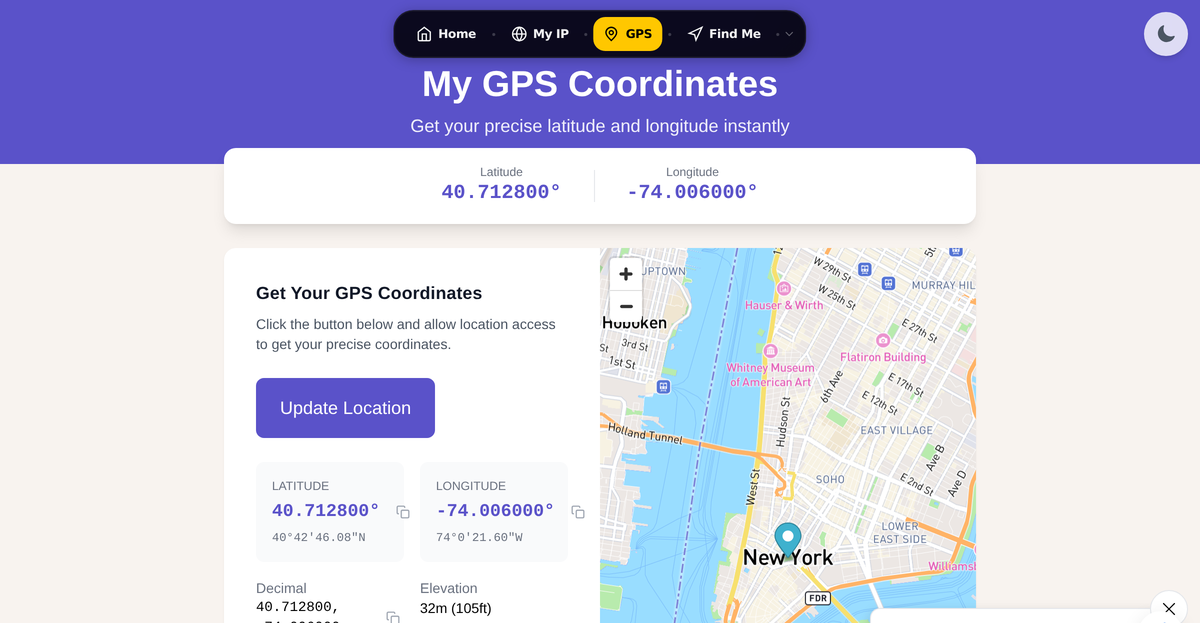
Online: Visit /gps-coordinates to see your exact position in multiple formats if you have a browser available.
Speaking Coordinates Clearly
GPS coordinates have two parts: latitude (north or south, -90 to +90) and longitude (east or west, -180 to +180). When speaking them over the phone:
- Say "latitude" first, then read each digit slowly: "four zero point seven one two eight north"
- Confirm the dispatcher repeated it back before continuing
- Say "longitude": "seven four point zero zero six zero west"
- Ask them to read both back to you
| Format | Example | Best Use |
|---|---|---|
| Decimal degrees | 40.7128, -74.0060 | Texting, typing |
| Degrees/minutes/seconds | 40°42'46"N 74°00'22"W | Verbal, easier to confirm |
| UTM | 18T 583960 4507523 | Military, search and rescue |
For more on coordinate formats, see Decimal Degrees vs DMS Explained.
Method 4: what3words
what3words divides the planet into 57 trillion 3-meter squares, each assigned a unique three-word combination. Saying "filled dot count dot soap" is easier to convey over a noisy phone call than reading out eight digits of coordinates. The app works offline once downloaded and the word database is cached.
Over 85% of UK police forces use what3words, as do more than 250 US public safety agencies. It is also available to about 4,800 Emergency Communications Centers in the US via RapidSOS.
To use it in an emergency:
- Open the what3words app (location access must be on)
- Your three-word address appears immediately
- Read it to the dispatcher: "My what3words address is [word one] dot [word two] dot [word three]"
- Spell unusual words phonetically if needed
- Tap your address to also see the GPS coordinates as a fallback
A Note on what3words
what3words is a proprietary, closed-source commercial product. Researchers have identified that two similarly-named three-word squares can be located close together, which creates potential for miscommunication. A 2023 academic paper recommended it not be adopted as critical infrastructure without evaluation against alternatives. It is a useful backup tool, not a replacement for GPS coordinates or AML. In my testing, it remains the quickest way to verbally convey a precise off-road position when the dispatcher is familiar with it. Always confirm the dispatcher can look it up before relying on it as your only method.
Method 5: Location Sharing Apps
For ongoing trips where someone needs to monitor your progress, a persistent location share is more practical than a one-time SOS.
Google Maps:
- Tap your profile picture, then Location sharing
- Choose a duration (from 15 minutes to indefinitely)
- Select a contact or copy a share link
Apple Find My:
- Open Find My, tap People, then Share My Location
- Choose a contact and duration
- They see your real-time position in their Find My app
My rule for day hikes: start an indefinite share before I leave the trailhead, send the link to someone who knows my plan, then stop sharing when I am back at the car.
Method 6: Satellite Beacons for Wilderness
When there is no cellular coverage and no Wi-Fi, dedicated satellite hardware is the only option.
Personal Locator Beacons (PLBs)
PLBs transmit on 406 MHz to the COSPAS-SARSAT satellite constellation. Press the SOS button and your GPS coordinates go to a satellite, which relays them to a ground station, which contacts search and rescue. The process is nearly instantaneous once the satellite overhead picks up the signal. PLBs require no subscription, are globally monitored 24/7, and have batteries rated for six or more years. The tradeoff is they are one-way only. No one can tell you help is coming.
Typical devices cost $250-$350 (ACR ResQLink 400, Ocean Signal RescueMe PLB1, McMurdo FastFind 220).
Satellite Messengers
Two-way devices let you send and receive short messages and confirm a response team is en route.
| Device | Two-Way | Subscription | Notes |
|---|---|---|---|
| Garmin inReach Mini 2 | Yes | $14.95-$64.95/mo | Pairs with phone, widest coverage |
| SPOT Gen4 | No | $11.95-$17.95/mo | Simpler, cheaper, check-in button |
| Zoleo | Yes | $20-$50/mo | Blends satellite with cellular when in range |
What to Say When You Call
Location alone does not tell dispatchers what to send. A short, structured message speeds response.
L - Location: "My GPS coordinates are 40.7128 north, 74.0060 west" or your what3words address
I - Identity: Your name and a brief physical description
O - Occurrence: "I have fallen on a trail and cannot walk"
N - Need: "I need an ambulance and search and rescue"
Always give your phone number at the start in case you are disconnected.
Before You Go: Setup Checklist
Do these before heading out, not during a crisis:
- [ ] Set emergency contacts in iPhone Health app or Android Safety and emergency settings
- [ ] Download the what3words app and open it once to cache the offline database
- [ ] Practice finding your GPS coordinates in both the Compass app and Google Maps
- [ ] Enable Emergency SOS on your phone and know how to trigger it
- [ ] For wilderness trips: carry a PLB or satellite messenger if going beyond reliable cellular coverage
- [ ] Tell someone your route and expected return time
- [ ] Charge your phone fully and carry a small power bank on multi-hour trips
- [ ] Know the local emergency number: 911 (US/Canada), 999 (UK), 112 (EU-wide)
Visit /gps-coordinates to see your current coordinates and practice reading them, or use /find-my-location to see how different location methods compare.
FAQ
Does calling 911 automatically share my location?
In the US and many other countries, yes. When you call an emergency number on a modern Android or iPhone, Advanced Mobile Location (AML) and similar protocols automatically send your GPS, Wi-Fi, and cell-tower position to the call center without any action from you. Coverage depends on whether your local call center has deployed compatible infrastructure. Over 30 countries had AML-capable infrastructure as of mid-2026. It does not replace telling the dispatcher your location verbally, because the fix may not always arrive.
What is the best app to share location in an emergency?
There is no single best app for every situation. The Compass app on iPhone and Google Maps on Android let you copy raw GPS coordinates with two taps, which works with any dispatcher worldwide. what3words is useful when you are off-road and need to verbally communicate a precise spot. For ongoing trip monitoring, Google Maps location sharing or Apple Find My are reliable because they require no special app on the recipient's side.
How does Emergency SOS via satellite work on iPhone?
When iPhone 14 or later cannot find a cellular signal and you trigger Emergency SOS, the phone guides you to point toward a clear sky. A compressed text message travels via Globalstar satellites to a relay center, which then contacts local emergency services and passes along your GPS coordinates. The feature is available in about 18 countries including the US, Canada, and most of Western Europe. Apple has extended free access for iPhone 14 and 15 owners through at least November 2026.
Is what3words reliable for calling 911?
It is a useful additional tool, not a sole method. Over 250 US public safety agencies recognize what3words, but coverage varies by county. A 2023 research paper flagged risks from similarly-named word squares being located close together. Always confirm the dispatcher can look up what3words before relying on it alone, and have your GPS coordinates ready as a backup. GPS coordinates work everywhere without any app dependency.
What should I do if my phone dies during a wilderness emergency?
Signal for help using universal distress patterns: three blasts of a whistle, three flashes of a mirror or headlamp, or three fires in a triangle. The SOS pattern (three short, three long, three short in sound or light) is internationally recognized. If you are hiking, a PLB is the most reliable offline backup because it operates completely independently of your phone and requires no subscription.
Sources
- Apple Support: Use Emergency SOS via satellite on your iPhone
- Apple Support: Use Crash Detection on iPhone or Apple Watch
- Google: How Android Emergency Location Service works
- what3words: Which emergency services accept what3words
- NOAA SARSAT: How the Cospas-Sarsat System Works
- Samsung Business Insights: How to set up Emergency SOS on Galaxy devices

WhatIsMyLocation.org Team
Our team of network engineers and web developers builds and maintains 25+ free networking and location tools used by thousands of users every month. Every article is reviewed for technical accuracy using real-world testing with our own tools.
Related Articles
Try Our Location Tools
Find your IP address, GPS coordinates, and more with our free tools.